Data and Tools

Jupyter Hub
A Jupyter Hub, a collaborative environment for Jupyter notebooks, will be accessible starting in early 2025. The Jupyter Hub will be populated with relevant scripts, data analyses, and visualizations developed throughout the project
SCalSIT
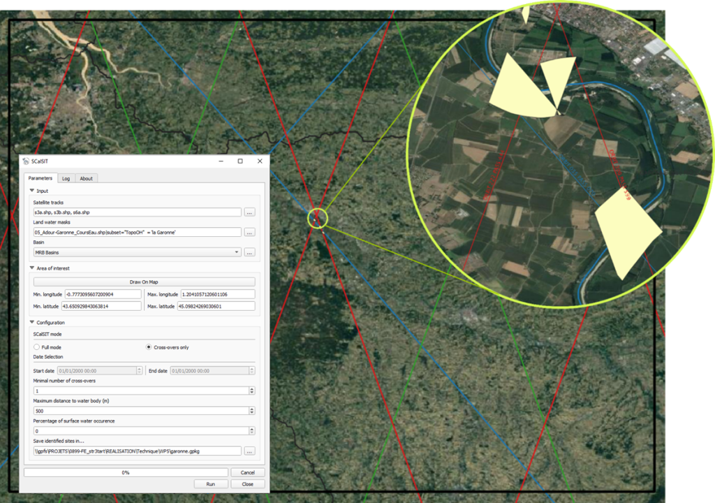
The Super Cal/Val Site Identifier Tool (SCalSIT) software aims to support the Cal/Val community and scientists in identifying potential in-situ Cal/Val sites over Inland Water Surfaces, to contribute to the validation activities effort of the Copernicus Sentinel-3 STM mission, but also to perform in-situ hydrological measurements for downstream applications or R&D. It has been developed as a QGIS Plugin, but can be used in command line, through Docker. Please contact us if you want to download it.